UN
6 Cutter Close
£ 300,000
Description
We don't have a Description for this property.
- Bedrooms
- 2
- Bathrooms
- 0
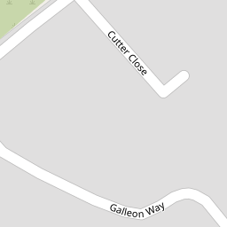

Leaflet © OpenStreetMap contributors
The heatmap indicates the level of crime in the area. The color of the heatmap indicates the crime severity and recency.
Metrics Year-on-Year
- Average area value
- 428,831.00 £Increased by 14.91 %
- Average area rental value
- 1,521.00 £/moIncreased by 0.66 %
- Est rental Yield
- 4.26 %Decreased by 12.35 %
- Crime Rate
- 13.00 %Unchanged by 0.00 %
from 373,202.00 £
from 1,511.00 £/mo
from 4.86 %
from 13.00 %
Nearby Schools
| Name | Type | Ofsted | Distance |
|---|---|---|---|
| Chattenden Primary School | Academy Converter | Good | 0.76 KM |
| St Mary'S Island Church Of England (Aided) Primary School | Voluntary Aided School | Good | 1.19 KM |
| Forward2 Employment Limited | Special Post 16 Institution | 1.85 KM | |
| Wainscott Primary School | Academy Sponsor Led | 1.90 KM | |
| Midkent College | Further Education | Good | 2.57 KM |
Images
Nearby Streets
| Name | Average Price | Average Sqft | Distance |
|---|---|---|---|
| Beacon Hill Lane | £ 2,200,000 | 0 | 0.00 KM |
| Elm Avenue | £ 471,167 | 0 | 0.00 KM |
| Augustus Way | £ 359,373 | 0 | 0.00 KM |
| Copse Farm | £ 430,000 | 0 | 0.00 KM |
| Vanguard Way | £ 400,000 | 0 | 0.00 KM |
Nearby Transport
| Name | NLC | TLC | Distance |
|---|---|---|---|
| Rochester | 5203 | RTR | 3.51 KM |
| Strood (Kent) | 5191 | SOO | 3.51 KM |
| Chatham | 5199 | CTM | 3.56 KM |
| Gillingham (Kent) | 5169 | GLM | 3.69 KM |
| Higham | 5202 | HGM | 7.03 KM |
Nearby Listings
| Address | Price | Type | Score | Distance |
|---|---|---|---|---|
| Cutter Close, Upnor, Rochester, ME2 | £ 300,000 | BUY | Unknown | 0.04 KM |
| Galleon way, Upnor | £ 665,000 | BUY | Unknown | 0.05 KM |
| Fleet House, Upnor Road, Upnor | £ 465,000 | BUY | 6 / 10 | 0.11 KM |
| Fleet House, Upnor Road, Upnor | £ 465,000 | BUY | Unknown | 0.11 KM |
| Ordnance Yard, Upnor Road, Lower Upnor | £ 259,995 | BUY | Unknown | 0.14 KM |
Nearby Properties
| Address | Price | Distance |
|---|---|---|
| 14 Cutter Close | £ 140,000 | 0.00 KM |
| 3 Cutter Close | £ 270,000 | 0.00 KM |
| 12 Cutter Close | £ 255,000 | 0.00 KM |
| 6 Cutter Close | £ 300,000 | 0.00 KM |
| 8 Cutter Close | £ 185,000 | 0.00 KM |